A3b _a1
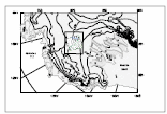
Figure 2: A close-up view of West Antarctica centered on the Western Divide region considered for ice coring as part of WAISCORES. The colored inset are ice thickness (interpreted as colors) and surface elevation contours over a 222 by 222 km region that was surveyed at 5.3 km line spacing by the University of Texas. The inset box shows the region of Figures 3 and 4. (Morse, personal communication, 2000.)
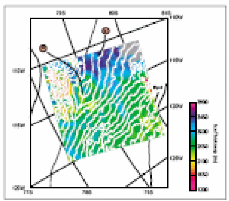
Figure 3: Ice thickness (colors) and 25 m surface elevations contours of the Western Divide region of central west Antarctica. The locations of the North (N) and South (S) candidate sites discussed are indicated. These sites correspond with sites G and E described on the site selection web site maintained at the University of Texas (http://www.ig.utexas.edu/research/projects/wais/inland/inland.html.) (Morse, personal communication, 2000.) A3b _a2
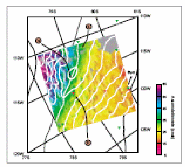
Figure 4: Snow accumulation rates (ice equivalent) for the Western Divide airborne survey region from mapping of spatially continuous radar layers. The values are an average over the last 2,700 years normalized the by the ~200 year value measured at site "D" by the University of New Hampshire in 1995/96 (Kreuz, Mayewski ref). (Morse, personal communication, 2000.)
A3b _a3